How to use drone deploy – How to use DroneDeploy? It’s easier than you think! This guide takes you from creating your account to analyzing your data, unlocking the power of drone imagery for various applications. We’ll cover everything from planning your flights and executing them safely to processing the data and creating impressive reports. Get ready to take your drone operations to the next level.
We’ll walk you through the DroneDeploy platform’s core features, providing step-by-step instructions for each stage. You’ll learn how to plan efficient flight paths, considering factors like battery life and wind conditions, and how to troubleshoot common issues that may arise. By the end, you’ll be confident in using DroneDeploy to capture, process, and share high-quality aerial data.
Getting Started with DroneDeploy
DroneDeploy is a powerful cloud-based platform for planning, flying, and processing drone data. It simplifies the entire workflow, from mission planning to data analysis, making it accessible to both beginners and experienced drone operators. This section will guide you through the initial steps of using DroneDeploy, including account creation and project setup.
Creating a DroneDeploy Account
Setting up your DroneDeploy account is straightforward. Visit the DroneDeploy website and click on the “Sign Up” button. You’ll need to provide a valid email address and create a password. After submitting your information, you’ll receive a verification email. Click the link in the email to activate your account.
You may also need to provide some additional information about your drone and your intended use cases.
Setting Up a DroneDeploy Project
Project setup is crucial for organizing your drone missions and data. Within the DroneDeploy platform, you’ll define the area you want to survey, specifying project boundaries using a map interface. This step also involves setting flight parameters, such as altitude, speed, and overlap percentage, ensuring optimal data capture for your project’s needs. Accurate boundary definition is critical for efficient flight planning and data processing.
Consider factors like the size of the area, desired resolution, and drone capabilities when defining these parameters.
Planning Your Drone Flight
Effective flight planning is essential for successful drone missions. DroneDeploy provides intuitive tools to design efficient flight paths, optimizing battery life and accounting for environmental factors like wind conditions. This section covers the key aspects of flight planning within the DroneDeploy platform.
Designing a Flight Plan
DroneDeploy’s flight planning tools allow you to easily create a flight plan by drawing polygons or importing shapefiles outlining the area of interest. The platform automatically generates a flight path, optimizing it for efficient coverage while considering factors like battery life and wind speed. You can manually adjust waypoints and flight parameters to fine-tune the plan. Remember to always factor in the wind speed and direction as it can significantly impact your drone’s flight and data accuracy.
Setting Waypoints, Altitude, and Speed
Waypoints define the drone’s flight path. DroneDeploy allows you to manually adjust waypoints or let the software automatically generate them based on the project boundaries. You can also specify the flight altitude and speed, balancing data resolution with flight time and battery consumption. Higher altitudes generally cover a larger area per flight but result in lower resolution images.
Conversely, lower altitudes provide higher resolution but require more flights to cover the same area. Choosing the optimal altitude and speed requires careful consideration of your project’s specific needs and your drone’s capabilities.
Pre-Flight Checklists and Safety Protocols

Before every flight, a thorough pre-flight checklist is crucial. This includes verifying battery levels, checking for obstructions, confirming weather conditions are suitable for flight, and ensuring the drone’s GPS signal is strong. Always review and adhere to local regulations and airspace restrictions. DroneDeploy’s in-app features often include helpful checklists and reminders to ensure you are following best practices for safe and legal operation.
Executing the Drone Flight
Once the flight plan is ready, connecting your drone and initiating the automated flight is relatively simple. DroneDeploy provides real-time monitoring capabilities to ensure the mission proceeds as planned. This section details the flight execution process and troubleshooting tips.
Connecting Your Drone and Initiating Flight
Connect your compatible drone to the DroneDeploy mobile app via Wi-Fi or other designated connection method. Once connected, review the flight plan one last time. After confirming everything is correct, initiate the automated flight. The app will guide you through the process, providing real-time feedback and updates.
Monitoring Flight Progress and Handling Issues
During the flight, DroneDeploy provides real-time monitoring of the drone’s location, battery level, and other key metrics. If issues arise, such as low battery or GPS signal loss, the app will provide alerts, and you may be able to take corrective actions remotely, or you may need to manually land the drone. Understanding the app’s alerts and how to react to them is critical to successful flight operations.
Getting started with DroneDeploy is easier than you think! First, you’ll want to set up your account and connect your drone. Then, you’ll plan your flight path, making sure to cover the area you need. For a detailed step-by-step guide, check out this awesome resource on how to use DroneDeploy to get you flying in no time.
After your flight, you’ll process the data and get amazing aerial images. Mastering DroneDeploy opens up a whole new world of possibilities!
Ensuring Accurate Data Capture, How to use drone deploy
Optimal lighting and weather conditions are crucial for accurate data capture. Avoid flying in direct sunlight or during periods of heavy cloud cover, as these conditions can affect image quality. Consistent lighting throughout the flight is important for consistent color and contrast in the final processed data. Weather conditions like strong winds can also negatively impact data accuracy and should be avoided.
Processing and Analyzing Data: How To Use Drone Deploy
After the flight, upload the drone imagery to DroneDeploy for processing. The platform offers various data processing options, enabling the creation of orthomosaics, 3D models, and other valuable data products. This section will explain the data processing workflow and interpretation of the results.
Uploading Imagery and Processing Options
Once your flight is complete, upload the captured imagery to your DroneDeploy project. The platform automatically processes the images, generating various data products. Choose from options like orthomosaic creation (a georeferenced mosaic of images), 3D model generation, and point cloud data. Processing time depends on the size of the dataset and the chosen processing options.
Accessing and Interpreting Processed Data
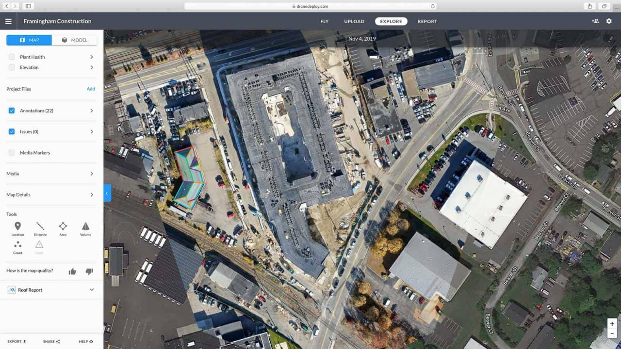
After processing, you can access and view the generated data products within the DroneDeploy platform. Orthomosaics provide a high-resolution, georeferenced image of the surveyed area. 3D models offer a three-dimensional representation of the terrain. Analyze the data to identify key features, measure distances, and extract other relevant insights. The platform often provides tools for measurement and annotation, facilitating a more detailed analysis.
Sharing and Collaborating
DroneDeploy simplifies the process of sharing your processed data and reports with collaborators and stakeholders. This section details the methods for sharing your findings and exporting data in various formats.
Creating and Sharing Reports
DroneDeploy allows you to create professional reports directly from the processed data. Include relevant measurements, annotations, and key findings. Organize the report in a clear and concise manner, making it easily understandable even for non-technical audiences. You can export the report in various formats, such as PDF, for easy sharing.
Exporting Data in Various Formats
DroneDeploy supports exporting data in various formats, including common geospatial formats like GeoTIFF for orthomosaics, and formats suitable for use in other GIS software. This allows for easy integration with other workflows and applications. The available export options depend on your subscription level.
Advanced DroneDeploy Features
DroneDeploy offers several advanced features to enhance your workflow and data analysis capabilities. This section highlights some of these features, compares different subscription plans, and discusses software integrations.
Advanced Features Overview
Explore advanced features like thermal imaging analysis (for detecting temperature variations), time-lapse video creation (for monitoring changes over time), and advanced measurement tools. These features often require specific hardware or higher-tier subscription plans. Understanding the capabilities of these features will help you choose the right plan for your needs.
DroneDeploy Plans and Features

DroneDeploy offers various subscription plans, each with different features and capabilities. Higher-tier plans often include access to advanced features, increased processing capacity, and more storage space. Carefully compare the plans to choose the one that best suits your budget and project requirements.
Software Integrations
DroneDeploy integrates with other software platforms, allowing seamless data transfer and analysis. Explore integrations with GIS software, CAD programs, and other relevant applications to streamline your workflow. This integration often simplifies the process of incorporating drone data into existing workflows.
Troubleshooting Common Issues

This section provides a troubleshooting guide to help resolve common issues encountered when using DroneDeploy.
| Problem | Cause | Solution | Prevention |
|---|---|---|---|
| Flight Plan Fails to Upload | Incorrect file format or corrupted file | Check file format, re-upload a properly formatted file. | Use DroneDeploy’s recommended file formats. |
| Drone Disconnects During Flight | Weak signal, interference | Ensure strong signal, move to an area with less interference. | Conduct pre-flight checks of signal strength, fly in areas with minimal interference. |
| Data Processing Errors | Insufficient image overlap, poor image quality | Check image overlap, re-fly with improved image quality. | Ensure sufficient image overlap, fly in optimal lighting and weather conditions. |
| Account Access Issues | Incorrect password, forgotten password | Reset password using the “Forgot Password” function. | Use a strong and memorable password. |
Illustrating Data Visualization
This section provides detailed descriptions of the processed data visualizations generated by DroneDeploy.
Getting started with drone mapping? Figuring out how to use DroneDeploy software can seem tricky at first, but it’s really straightforward once you get the hang of it. Check out this awesome guide on how to use DroneDeploy to learn the basics of flight planning and data processing. After that, you’ll be creating professional-looking maps in no time – it’s all about mastering the workflow within the DroneDeploy platform.
Orthomosaic Image Description
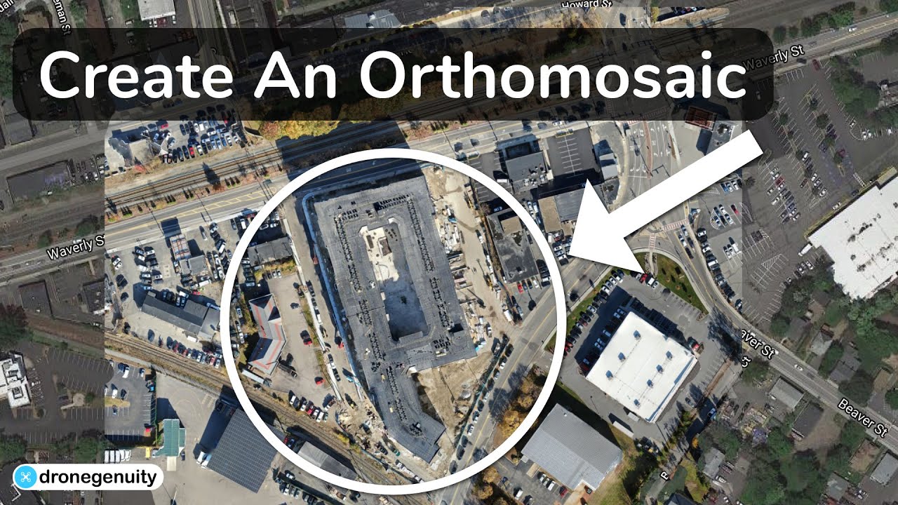
A processed orthomosaic image from DroneDeploy typically presents a georeferenced, high-resolution, two-dimensional representation of the surveyed area. The color accuracy depends on various factors including lighting conditions during the flight and the processing parameters used. The resolution is determined by the camera’s sensor size, flight altitude, and image overlap. The scale is typically indicated on the image itself or can be derived from the metadata.
Annotations, such as measurements and labels, can be added to highlight specific features of interest.
3D Model Description
A 3D model generated from drone data using DroneDeploy provides a three-dimensional representation of the terrain and features within the surveyed area. The level of detail depends on the resolution of the input imagery, the processing parameters, and the density of the point cloud data. Accuracy is affected by various factors, including GPS accuracy during the flight, and the processing algorithms used.
Potential applications include volume calculations, terrain analysis, and visualization for various purposes such as construction planning, mining, or agriculture.
Mastering DroneDeploy empowers you to leverage the full potential of your drone. From efficient flight planning to insightful data analysis, you’ve learned the skills to capture stunning aerial imagery and transform it into valuable information. Remember to practice safety protocols, explore advanced features, and continue learning to refine your drone operations. Happy flying!
Answers to Common Questions
What types of drones are compatible with DroneDeploy?
DroneDeploy supports a wide range of drones, including DJI, Parrot, and many others. Check their compatibility list for the most up-to-date information.
How much does DroneDeploy cost?
DroneDeploy offers various subscription plans with different features and pricing. Check their website for the current pricing structure.
Can I use DroneDeploy offline?
While some features require an internet connection, you can plan flights offline and download processed data for later review.
What file formats can I export from DroneDeploy?
You can export data in various formats including orthomosaics (TIFF, GeoTIFF), 3D models (OBJ, LAS), and point clouds.
